Mapperty Inc. bridges the gap between the field and the office. It empowers professionals to capture, visualize, and manage real-world spaces – faster and with greater precision.
Whether it’s surveying a site or navigating a 3D model, Mapperty Inc. ensures every project stays accurate, connected, and ready for action.
Who Needs Mapperty Inc.?
Built for anyone measuring, mapping, or designing spaces.
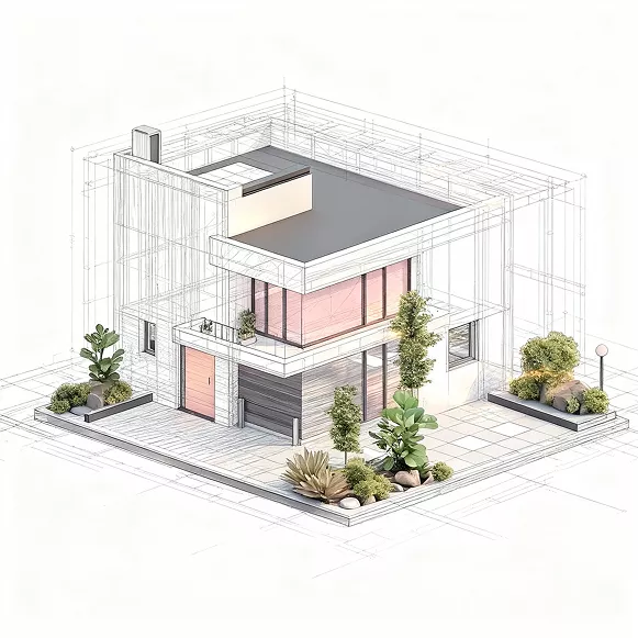
Spaceview
Homeowners & Storeowners
Visualize your space before it’s built or renovated.
Architects & Designers
Bring precision and clarity to every concept.
Contractors & Builders
Coordinate teams with up-to-date project information.
Real Estate Professionals
Present, sell, and manage properties with interactive 3D visuals.
Appraisers
Evaluate spaces quickly with detailed 3D insights.
Quickplot
Surveyors & Field Engineers
Capture and validate site data seamlessly.
Architects & Designers
Base designs on precise, real-world measurements.
Contractors & Builders
Receive verified survey data for construction planning.
CAD Teams
Work directly with CAD-ready outputs from field surveys.
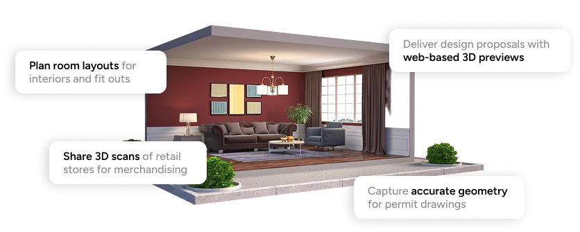
Where Mapperty Spaceview Makes a Difference
Smart tools for smarter spaces.
Hear it From our Users
Don’t take our word for it - take theirs.
Jenna Kim
Real Estate Agent
“We highly recommend Mapperty! It has transformed the way we present spaces to clients. The 3D visuals make presentations so much more engaging.”
Rachel Owens
Homeowner
“I used Spaceview to plan my home renovation. Being able to see the layout in 3D before making decisions gave me so much confidence.”
Gill Byron
Interior Designer
“With Spaceview, it is now incredibly simple to plan, draft, and visualize designs. It’s now an essential part of my workflow.”
Blogs
Scan Tips
Heading Heading Heading Heading :
Heading
Streamline project execution with precise layouts and easy revision handling. Streamline project execution with precise layouts and easy revision handling.Streamline project execution with precise layouts and easy revision handling.
Scan Tips
Heading Heading Heading Heading :
Heading
Streamline project execution with precise layouts and easy revision handling. Streamline project execution with precise layouts and easy revision handling.Streamline project execution with precise layouts and easy revision handling.
Scan Tips
Heading Heading Heading Heading :
Heading
Streamline project execution with precise layouts and easy revision handling. Streamline project execution with precise layouts and easy revision handling.Streamline project execution with precise layouts and easy revision handling.
FAQs
What is Mapperty Estimator?
Mapperty Estimator is a smart application designed to simplify property damage inspection for insurance claim adjusters. It streamlines the claim process by minimizing manual work.
Who can benefit from Mapperty?
Mapperty Estimator is tailored for insurance companies, claim adjusters , policy holders, homeowners, contractors, and insurance attorneys. By providing claim estimation in a single day, it expedites the claim process for these professionals increasing their work efficiency.
How does Mapperty minimize manual work for claim adjusters?
Mapperty Estimator replaces traditional manual processes, allowing adjusters to digitize property inspections, generate reports, and manage projects seamlessly.
Does Mapperty provide chat support?
Yes, based on the selected plan, customer support will be provided by Mapperty. A dedicated account manager will be assigned to eligible plan holders. For general queries, clients can fill out a form or contact the support team via email.