Mapperty Sketch

Perfect for civil and land surveyors, our mapperty sketch is built for people operating at the heart of multiple development projects.

Choose An Input That Works For You

We care about enabling you to use the input methods you’re most confident with. That’s why with Mapperty, you needn’t worry about having the wrong technology for capturing and uploading point clouds of a property. Our End-to-End app is capable of turning data from a wide range of inputs into comprehensive site plans, including iPhone 13/iPhone 13 Pro devices, drone photogrammetry, GeoSLAM cameras or any other LiDAR-based input device. Additionally, by opting for Mapperty’s tablet-based app, you can also upload digital sketches of a site, and our proprietary CAD engine will convert it into an equally detailed .PDF or .DWG site plan without difficulty.

Unlimited Drafting Support

Mapperty’s experienced design team is on hand to offer unlimited drafting support. Whether you’re seeking assistance in using the various functions of the Mapperty app or simply need human reclassification of our software’s algorithmic outputs, we’re here to deliver outstanding support whenever you need it.

Create Brand Templates

Create Brand Templates

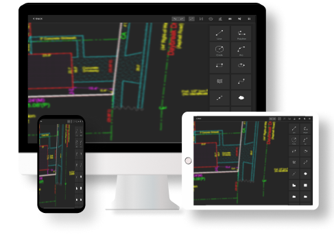
As a surveyor, your brand is one of your most valuable assets. With Mapperty, you can store and reuse an array of branded elements including specific blocks, lines types, legends, logos, fonts and more to keep your work brand-consistent and maintain your high reputation. Our tools also allow you to create a surveyor profile by uploading design templates, insurance details and clients.

10GB of Cloud Storage

10GB of Cloud Storage

With 10GB of complementary cloud storage, you don’t have to worry about backing up project-critical plans, data and documents. You can rest easy in the knowledge that it’s stored securely in our servers.

Multiple Logins

Multiple Logins

Logistical difficulties and inadequate communication tools are one of the most significant factors behind project delays. With login access for up to five managers and five crew members, you can ensure that your entire team is able to access and review the same information from the earliest stages of planning to the finishing touches of construction

Manage Projects & Track Job Status

With the ability to juggle multiple jobs, assign drafters, field crew members, manage clients, access quality checks and manage invoices, Mapperty puts the power in your hands to oversee every project with ease. Plus, with geolocation technology, you can find out where your team members are located at any point during the work day.

Pricing

Mapperty Sketch

  • Designed for land surveyors
  • Choice of tablet-based sketch app OR iPhone 13/Pro-based site plan processing app.
  • Unlimited drafting support
  • Document manager
  • 10GB cloud storage
  • Project manager
  • 5 manager logins and 5 crew logins

Mapperty BIM

  • Designed for realtors, architects and homeowners
  • Functions with the iPhone-based Mapperty scan app
  • Unlimited design support.
  • Complementary document management/sharing tools
  • Revit conversion service